The 2004 Atlantic Hurricane season started off slow. The first storm did not form till early August. Then came the flood of tropical activity that lasted until the very end of the hurricane season. 2004 was also a destructive year for the US state of Florida. In 2004 4 powerful hurricanes would strike the US state of Florida in a 7 week time period. Charley was the first of 4 destructive hurricanes to hit the Sunshine state.
Charley originated from a tropical wave that came off the coast of Africa around August 4th or 5th. Due to dry air the tropical wave did not develop for the next several days. However, on August 9th convection started to fire up around the wave. Satellite data showed the tropical wave was becoming better organized. Computer models started to show the wave becoming a significant hurricane. Later that night it was declared a tropical depression by the National Hurricane Center.
On August the 10th the depression entered the Eastern Caribbean. Due to warm waters the depression became better organized. Winds went from 35 mph to 45 mph and it was named Charley. High Pressure to the North started to pull Charley in a northwestern pattern. In the meantime Charley continued strengthening by August 11th winds had gone from 50 mph to 65 mph. Later in the Afternoon on the 11th the winds went from 65 to 75 making Charley a hurricane.
Hurricane Charley despite moving at a good clip underwent further strengthening. On August the 12th the winds increased to 100 mph and the pressure started to significantly drop. This made Charley a category 2 hurricane. Later on the 12th Charley became a 115 mph category 3 hurricane making Charley a Major Hurricane. It became clear that the storm would make landfall in Cuba and then Southwest Florida. The Hurricane Center and Florida's National Weather services started issuing how anyone from Tampa to Key West Florida could be impacted by Charley.
Charley continued to get stronger right before landfall. On the evening of August 12th Charley made landfall in Cuba as a 120 mph category 3 hurricane. The hurricane's fast movement and the flat area it came ashore in did not disrupt Charley too much. early morning on the 13thh it was a high end category 2 hurricane with winds up to 110 mph. On the 14th Charley went more rapid intensification. Winds increased from 110 mph to 125 mph the pressure went from 964 millibars to 950 millibars. That evening Charley became a category 4 hurricane with winds up to 145 mph. The small but powerful Hurricane made landfall In Southwest Florida near Fort Myers, Marco Island, and Cape Coral as a 150 mph category 4 hurricane with a pressure of 941 millibars. This made Charley a high end category 4 hurricane.
Charley produced over 100 mph winds even further inland. While Orlando was spared from the storm surge due to being inland. Charley produced 105 mph winds in the city doing lots of wind damage. Due to being over land for several hours Charley weakened but was still a hurricane when it emerged in the Atlantic Ocean with winds up to 75 mph. Charley then accelerated toward South Carolina. Despite its very fast motion the storm was able to strengthen. Charley struck South Carolina as a 85 mph category 1 hurricane on August the 15th. Shortly after landfall Charley lost its tropical characteristics.
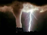
In Southwest Florida Charley produced a storm surge that was reported over 12 feet. Winds at the surface where measured at 150 mph. Further inland Charley produced 20 tornadoes in the state of Florida. 100 mph winds did damage in inland areas. In South Carolina Charley produced a 7 foot storm surge, winds over 80 mph, and 5 tornadoes.
In Cuba Charley claimed 4 lives and caused $1 Billion in damages. In Florida Charley killed 29 people and caused $15 Billion dollars worth of damage, and in South Carolina Charley killed 2 people and caused $1 Billion dollars worth of damage. Overall, Charley killed 35 people and caused $17 Billion dollars worth of damage with $16 billion being done in the USA alone.
In conclusion, Charley was the first of 4 destructive hurricanes to hit the US state of Florida. It was also the first of 5 hurricanes to strike the United States in the year of 2004. Due to its destruction mainly in the US State of Florida the name Charley was retired. It should be noted Charley still ranks as one of the strongest hurricanes in terms of wind speed to strike the USA. Other strong hurricanes to strike the USA include Labor Day (1935) Camille (1969), Hugo (1989), Andrew (1992), Harvey (2018) Irma (2017), Maria (2017), Laura (2020), Ida (2021), and Ian (2022).
The 2004 Atlantic Hurricane season started off slow. The first storm did not form till early August. Then came the flood of tropical activity that lasted until the very end of the hurricane season. 2004 was also a destructive year for the US state of Florida. In 2004 4 powerful hurricanes would strike the US state of Florida in a 7 week time period. Charley was the first of 4 destructive hurricanes to hit the Sunshine state.
Charley originated from a tropical wave that came off the coast of Africa around August 4th or 5th. Due to dry air the tropical wave did not develop for the next several days. However, on August 9th convection started to fire up around the wave. Satellite data showed the tropical wave was becoming better organized. Computer models started to show the wave becoming a significant hurricane. Later that night it was declared a tropical depression by the National Hurricane Center.
On August the 10th the depression entered the Eastern Caribbean. Due to warm waters the depression became better organized. Winds went from 35 mph to 45 mph and it was named Charley. High Pressure to the North started to pull Charley in a northwestern pattern. In the meantime Charley continued strengthening by August 11th winds had gone from 50 mph to 65 mph. Later in the Afternoon on the 11th the winds went from 65 to 75 making Charley a hurricane.
Hurricane Charley despite moving at a good clip underwent further strengthening. On August the 12th the winds increased to 100 mph and the pressure started to significantly drop. This made Charley a category 2 hurricane. Later on the 12th Charley became a 115 mph category 3 hurricane making Charley a Major Hurricane. It became clear that the storm would make landfall in Cuba and then Southwest Florida. The Hurricane Center and Florida's National Weather services started issuing how anyone from Tampa to Key West Florida could be impacted by Charley.
Charley continued to get stronger right before landfall. On the evening of August 12th Charley made landfall in Cuba as a 120 mph category 3 hurricane. The hurricane's fast movement and the flat area it came ashore in did not disrupt Charley too much. early morning on the 13thh it was a high end category 2 hurricane with winds up to 110 mph. On the 14th Charley went more rapid intensification. Winds increased from 110 mph to 125 mph the pressure went from 964 millibars to 950 millibars. That evening Charley became a category 4 hurricane with winds up to 145 mph. The small but powerful Hurricane made landfall In Southwest Florida near Fort Myers, Marco Island, and Cape Coral as a 150 mph category 4 hurricane with a pressure of 941 millibars. This made Charley a high end category 4 hurricane.
Charley produced over 100 mph winds even further inland. While Orlando was spared from the storm surge due to being inland. Charley produced 105 mph winds in the city doing lots of wind damage. Due to being over land for several hours Charley weakened but was still a hurricane when it emerged in the Atlantic Ocean with winds up to 75 mph. Charley then accelerated toward South Carolina. Despite its very fast motion the storm was able to strengthen. Charley struck South Carolina as a 85 mph category 1 hurricane on August the 15th. Shortly after landfall Charley lost its tropical characteristics.
In Southwest Florida Charley produced a storm surge that was reported over 12 feet. Winds at the surface where measured at 150 mph. Further inland Charley produced 20 tornadoes in the state of Florida. 100 mph winds did damage in inland areas. In South Carolina Charley produced a 7 foot storm surge, winds over 80 mph, and 5 tornadoes.
In Cuba Charley claimed 4 lives and caused $1 Billion in damages. In Florida Charley killed 29 people and caused $15 Billion dollars worth of damage, and in South Carolina Charley killed 2 people and caused $1 Billion dollars worth of damage. Overall, Charley killed 35 people and caused $17 Billion dollars worth of damage with $16 billion being done in the USA alone.
In conclusion, Charley was the first of 4 destructive hurricanes to hit the US state of Florida. It was also the first of 5 hurricanes to strike the United States in the year of 2004. Due to its destruction mainly in the US State of Florida the name Charley was retired. It should be noted Charley still ranks as one of the strongest hurricanes in terms of wind speed to strike the USA. Other strong hurricanes to strike the USA include Labor Day (1935) Camille (1969), Hugo (1989), Andrew (1992), Harvey (2018) Irma (2017), Maria (2017), Laura (2020), Ida (2021), and Ian (2022).


 User Notice